Cycle San Pablo is hosting the following three events.
Cinco de Mayo Parade
May 3 from 10-11 a.m.
Richmond Civic Center
24th St & Barrett Ave, Richmond
Bike to Work Day
May 8 from 7-9 a.m.
Corner of Church Ln & San Pablo Ave, San Pablo
Bike Bonanza
May 30 from 3-5 p.m.
Wanlass Park
2999 21st St, San Pablo

Category: News
Bike Bonanza in San Pablo (2014)
The public is invited to the San Pablo Bike Bonanza
Bicycle activities, bike repairs, family bicycling rodeo, giveaways for all, helmets and more.
Friday, May 30th from 3-5 pm at Wanlass Park 2999 21st St, San Pablo.
For more information call (510) 215-3000

Construction Starts on SR-160/Hwy 4 Direct Connector Ramps (2014)

Construction Starts on SR 160/HWY 4 Direct Connector Ramps
State Route 160/Highway 4 Direct Connector Ramps Project is anticipated to start on Monday, March 24, 2014 in eastern Contra Costa County. The project will construct two new connector ramps, one connecting westbound Highway 4 to northbound SR 160, and one connecting southbound SR 160 to eastbound Highway 4. The ramps will create a connection between the Antioch Bridge and Highway 4 and provide residents and motorists in eastern Contra Costa County with important improvements in safety and mobility.
Motorists are urged to use caution and slow down when entering the construction zone.
The first week in April, crews will conduct three to four days of installing cast-in-drilled-hole (CIDH) piles to support the connector ramps. (This process has been selected because it does not generate significant noise, and will minimize impacts to the surrounding communities.) Beginning in mid-April, construction hours will be extended to include two to three weeks of nighttime work to minimize daytime traffic impacts and maintain the project schedule.
Click here to view a map of the project location.
County Connection is Seeking Public Input on Proposed Service Changes (2014)
The County Connection is proposing services changes focused in Walnut Creek and Martinez with some changes in Concord and Pleasant Hill. Visit County Connection’s website for more information and to submit a comment.
Capitol Corridor: Save 50% Off Weekend Travel (2014)

Let Capitol Corridor take you where you want to go. Interested in history? Check out Old Town Sacramento. Love science? Visit the Tech Museum in San Jose. Addicted to shopping? San Francisco’s the place to be. And now, through April 24, Capitol Corridor is half-off on the weekends.
Weekend travel is 50% off! Offer is valid for regular (full) adult rail fare.
CHP Start Smart Programa Para Conducir Con Seguridad (2014)
 CHP Start Smart Programa Para Conducir Con Seguridad Para conductores adolescentes y sus padres
START SMART es una gratuito clase educativa dos horas para conducir seguramente de dada por la Patrulla de Autopistas de California (CHP). La clase se enfoca en conductores adolescentes con licencias nuevas o futuras y sus padres/tutores legales
CÚANDO: Abril 3, 2014 7-9pm
DÓNDE:
Secundaria Liberty PAC
850 Second Street
Brentwood, CA 94513
¡También habrá una rifa que incluye 3 Visa tarjetas de regalo y 1 iPod Shuffle!
Para más información sobre el programa, visite www.chp.ca.gov o contacte a oficinas de CHP al 925-646-4980.
REGISTRO: El evento es GRATUITO y abierto a todos los estudiantes y padres de LUHSD, pero requiere registro. Haga clic aquí
STREET SMARTS DIABLO es un programa de seguridad vial que educa a peatones, ciclistas y conductores del Condado Contra Costa Central y del Este. Para más información visite www.streetsmartsdiablo.org o contáctenos en 925-969-0841 x213 / info@streetsmartsdiablo.org
CHP Start Smart Driving Safety Program
CHP Start Smart Driving Safety program for Teen Drivers and their Parents
START SMART is a free two-hour driver safety education class given by the California Highway Patrol (CHP). The class targets new and future licensed teenage drivers and their parents/legal guardians. Para Español
WHEN: April 3, 2014 7-9pm
WHERE:
Liberty High School PAC
850 Second Street
Brentwood, CA 94513
There will also be raffle prizes that include 3, $50 Visa gift cards and 1 iPod Shuffle!
REGISTER: The event is FREE and open to all LUHSD students and parents, but registration is requested Click here to register.
For more information about the program, visit www.chp.ca.gov or contact the CHP offices at 925-646-4980.
STREET SMARTS DIABLO is a traffic safety program that educates pedestrians, cyclists and drivers in Central and East Contra Costa County. For more information, visit www.streetsmartsdiablo.org or contact us at 925-969-0841 x213 / info@streetsmartsdiablo.org
County Connection: Proposed Service Changes in Martinez and Walnut Creek (2014)
The County Connection is proposing a service change in Martinez and Walnut Creek
Public workshops are scheduled to gather comments on proposed changes to routes in Walnut Creek and Martinez. Changes are proposed to improve performance and service quality. County Connection is seeking public comment on the proposed service changes.
Upcoming meeting dates and locations:
- Monday, March 17, 2014 – at Martinez City Hall, 525 Henrietta St. 4:00-6:00 PM
- Thursday, March 20, 2014 – Walnut Creek Library, 1644 Broadway 4:00-6:00 PM
Proposed Service Changes
Walnut Creek:
- Re-route the #7 to provide more frequent and direct service between Pleasant Hill BART and Shadelands
- Eliminate route #2 and modify route #5 to provide more frequent and direct service to Walnut Creek BART
Martinez:
- Modifications to #18 and #28 to increase service to the retail centers on Arnold. Service on Howe Rd. would be eliminated.
- Eliminate route #19 and redirect service hours to new community shuttle route.
- New Community shuttle route would operate between downtown Martinez and retail on Arnold (Walmart and Village Oaks Shopping Center)
Click here to view detailed maps for the changes.
Comments can be submitted in writing, via email, or at the two schedule public hearings listed above.
Email: planning@countyconnection.com
Address:
Director of Planning
2477 Arnold Industrial Way
Concord, CA 64520
Hilton Concord Employs Commute Alternatives (2014)

Staff recently visited the Hilton Concord as part of the Contra Costa Green Business Program certification process. We were delighted to learn that the Hilton encourages both hotel employees and guests to think about using alternative ways of traveling.
- Hilton employees are eligible for pre-tax commuter benefits to pay for transit expenses
- Nearly all employees live within a 10 mile radius of the hotel
- Around 50% of employees take the bus, bike or walk to work. A County Connection bus stop is located in front of the hotel entrance and the Iron Horse Regional Trail runs behind the property
- Bike racks are available to employees and guests alike


- A complimentary shuttle to and from the Concord BART station is available to hotel guests
- Eight (8) electric vehicle plug-in vehicle charging stations are available to the public; six (6) Level II and two (2) DC fast chargers on the Blink Network


We can’t wait to see what Hilton Concord does next!
See other sustainable practices Hilton Concord has implemented.
New Hillcrest Park & Ride Lot is Almost Ready to Open (2014)
 Commuters catching Tri Delta Transit buses at the current Hillcrest Park & Ride on a typical weekday afternoon
Big changes are coming up for the Hillcrest Park & Ride lot located in Antioch at the corner of Hillcrest Avenue and Sunset Drive. Starting Sunday, February 16, 2014, commuters will be parking a bit further up on Sunset Drive on Lot A of the upcoming eBART station.

The new parking lot will feature an additional 94 spaces for commuters. The bus loading area will also be relocated to an area adjacent to the future eBART station. Tri Delta Transit and other transit operators are recommending that you allow additional time to catch your bus. In anticipation of some confusion to the new changes, signs and ambassadors will be on site Tuesday, February 18th to help commuters.


511 CCTA is excited to see that the new Hillcrest Park & Ride lot is almost ready to open to the public. It looks like finishing touches are being put into place when staff stopped by for a preview.
By the end of 2017, all 1,000 spaces of BART’s Antioch (eBART) Station parking lot will be available for use for drivers who use Tri Delta Transit, eBART and other local public transit systems. And what will happen to the current parking lot? The old Hillcrest Park and Ride will be demolished to clear space for freeway onramps and offramps.
Information Source: Contra Costa Times, East County Today, Tri Delta Transit
Bay Area Commuter Benefits Program Public Hearing (2014)

WHO: Bay Area Air Quality Management District (BAAQMD)
WHAT: Public hearing to consider the adoption of proposed Regulation 14: Mobile Source Emissions Reduction Measures, Rule 1: Bay Area Commuter Benefits Program. The proposed rule will serve as the foundation for the Bay Area Commuter Benefits Program (Program).
WHEN: Wednesday, March 19, 2014 at 9:45am
WHERE: 939 Ellis Street, San Francisco, CA 94109 at the 7th Floor Board Room
WHY: The objective is to reduce emissions of greenhouse gases (GHGs) and criteria air pollutants by expanding the number of employers who provide commuter benefits to their employees.
Background
California Government Code § 65081 (added by Senate Bill 1339) authorizes BAAQMD and the Metropolitan Transportation Commission (MTC) to jointly adopt and implement a Bay Area commuter benefits ordinance on a pilot basis through 2016.
How it will affect employers
The proposed rule will require employers with 50 or more full-time employees in the Bay Area to select one of the following four commuter benefit options to offer to their employees:
- Allow employees to exclude their transit or vanpool costs from taxable income, up to the maximum amount allowed by current federal law;
- Provide a transit or vanpool subsidy to reduce, or cover, employees’ monthly transit or vanpool costs;
- Provide a low-cost or free shuttle, vanpool, or bus service for employees (operated by or for the employer); or
- Propose an alternative commuter benefit that would be equally as effective as the other options in reducing single-occupant vehicle trips (and/or vehicle emissions).
Employers will also be required to:
- Register through a web-based registration process;
- Designate a contact person;
- Notify employees of the commuter benefit selected and maintain records to document the implementation; and
- Provide information needed for Program evaluation.
What will happen
Should the Air District Board of Directors adopt the proposed rule and if MTC concurs with this action, then Bay Area employers would have six (6) months to comply with the requirements of the program.
Comments
You may submit comments to the proposed rule and supporting documents to commuterbenefits@baaqmd.gov or to
David Burch
Principal Environmental Planner
Bay Area Air Quality Management District
939 Ellis Street
San Francisco, CA 94109
Written comments must be received by 5pm Friday, February 21, 2014.
Proposed Rule and Supporting Documents
See also Bay Area Commuter Benefits Program Public Workshop
See also New Bay Area Commuter Benefit Policy
Bay Area Climate Protection Strategy Workshop (2014)
The Bay Area Air Quality Management District invites you to a workshop on the Clean Air Plan and to initiate development of a Bay Area Climate Protection Strategy.
When: February 28, 2014, 9:30 am – 11:30 am
Where: Air District Office, 939 Ellis Street, San Francisco, 7th Floor
The purpose of the workshop is:
- To kick off the planning process for updating the Clean Air Plan
- To initiate the planning process to develop a Climate Protection Strategy for the Bay Area, which will be included as new element of the Clean Air Plan
- To report progress on implementing the control measures in the 2010 Clean Air Plan
- To solicit ideas and strategies to further reduce ozone precursors (nitrogen oxides, volatile organic compounds), particulate matter, toxic air contaminants, and greenhouse gases
- To seek input on innovative strategies to reduce greenhouse gases, mechanisms for tracking progress in reducing GHGs, and how the Air District may further support actions to reduce GHGs
- To describe future steps and the overall schedule in developing the Clean Air Plan update and Bay Area Climate Protection Strategy
Contact: Christy Riviere at 415-749-4925 or criviere@baaqmd.gov
See the flyer for more information or visit: http://www.baaqmd.gov/Divisions/Planning-and-Research/Plans/Clean-Air-Plan-Update.aspx
The workshop will be webcasted LIVE on the above listed at http://www.baaqmd.gov/Divisions/Planning-and-Research/Plans/Clean-Air-Plan-Update.aspx. Take transit! Civic Center BART station and MUNI lines 47, 49, 38 are nearby. Bike racks located onsite. More transit info at www.511.org.
Freeway Maps as Public Transit Corridors
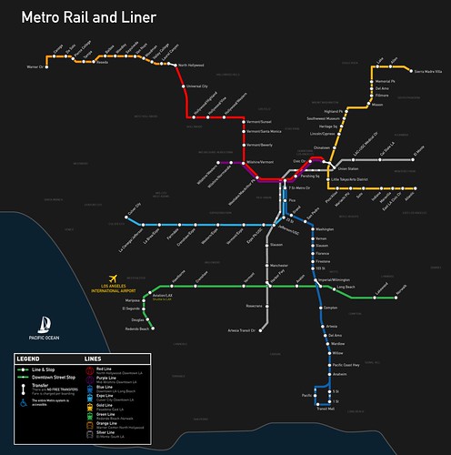
A map of Los Angeles’ current rail network. Image credit: Kriston Lewis
Los Angeles is being hailed for its steady revival of the thriving rail system it once had, but the current plan to create a convenient network that connects the whole county is still 30 years away. The Los Angeles rail system has seen rapid growth in usage with the most recent addition, the Expo Line, which was completed earlier this year.
Now, let’s imagine what the freeway system in L.A. would like like if it was a rail system? We have an idea thanks to “Stonebrown Design,” who has put together maps of L.A.’s freeway system as though it were a rail system:

Los Angeles’ freeway system, seen in rail map form. Screen-grab via: Stonebrown Design
Comparing the above Stonebrown Design map to the current Metro Rail map there is a clear visualization demonstrating that rail doesn’t serve as many people as the freeways do (yet!).
To see more detailed maps of L.A.’s freeways with a “public transit vision,” head over Stonebrown Design’s Greater Los Angeles Freeway System Map page (soon you’ll be able to purchase prints as well, due to a rather successful Kickstarter campaign).
Vintage 1976 BART Map
BART. The world’s most sophisticated rapid transit? Bay Area map maker and enthusiast Eric Fischer recently uploaded this 1976 BART brochure touting how its 2,000 employees care about its passengers.

The brochure text is reads:
“BART invites you to join us on the world’s most sophisticated rapid transit. BART is a space age transit system with over 2,000 people who care about you and it’s the most convenient way to get over, around, and under the Bay Area in minutes.”
The brochure goes on to describe how to access BART and the cost of parking at BART stations (which was free with the exception of the Lake Merritt Station, which would set you back 25 cents per day). Another interesting detail that emerges is in the text the portion about bikes on BART. While all bike restrictions have now been lifted, when the system opened you needed a temporary permit from a station agent to bring your bike on-board during certain hours.
Be sure to check out some of our other posts highlighting the early days of BART, plans that never happened, and what lies ahead.
(For all BART related posts, click on our “BART” tag.)
Removing The Conflict Between Buses and Bikes

A bicyclist peacefully overtakes a bus loading and unloading passengers. Photo credit: Canadian Veggie
If you commute by bike or bus, the conflict is familiar: a bus will overtake a person bicycling then arrive at a stop to pick up passengers, and while the bus is momentarily stopped the person bicycling will catch up and overtake the bus.

This effectively creates an unwanted game of “leap frog” in which bicycles and buses are constantly overtaking one another, sometimes causing near collisions since it can be difficult to see a bicycle approaching on the left as the bus driver attempts to re-enter the flow of traffic. As if contending with traffic weren’t stressful enough, this repeated negotiation can be exhausting and tense for both parties.
Thankfully, there is a solution– routing bicycles to the left of bus stops in a separated lane, known as “bike channel” or “bus bypass.” Here in the Bay Area, San Francisco has pioneered this practice on streets with streetcar stops where it seems to be working just as it should, removing the bus-bike conflict seen on heavily traveled routes throughout the region.
So it comes as good news that the practice will soon expand into the East Bay along AC Transit’s 51 route this summer as part of the “Line 51 Corridor Delay Reduction and Sustainability Project.” Not only is this anticipated to remove the common “leap frogging” conflict between buses and bikes, but this is also expected to help speed up bus times too– a win-win!
While the proposed orientation (which will look similar to the configuration in the lead photo) is unfamiliar in the East Bay, it certainly is not new. In The Netherlands, transportation planners have separated buses and bicycles at bus stops since as early as the 1950’s. To learn more about how this clever design improves conditions for everyone watch the video.
Video credit: markenlei
BART to Oakland Airport Connector Test Train Unveiled (2014)
BART officials today excitedly unveiled a test train for the 3.2-mile elevated tramway connector from the Oakland Coliseum station to the Oakland airport that’s scheduled to begin service in the fall. The Oakland airport connector train will enhance access to the airport using BART.
BART officials said the fares are expected to be roughly equivalent to the current $3 AirBART buses. The connector, which will travel at about 30 mph, will run above Hegenberger Road and replace the current AirBART buses, which drive through nine intersections on local streets. The tramway travel time between the Coliseum BART station and the Airport will take approximately 9 minutes and depart every 4 minutes. Compared to the current 20-25 minute AirBART bus trip, that’s quite a time-savings. “There will be a guarantee of the time that will be involved,” BART General Manager Grace Crunican said.
Four three-car trains will operate on the connector, with each train able to carry up to 150 passengers. Tom Dunscombe, the project manager for the connector, said the trains will be light and “elegant” because they won’t have motors, as the motors are in the wheelhouse. Dunscombe said the connector will be “really reliable,” with a projected on-time performance of 99.5 percent, because there will be redundant motors and gearboxes. He said if the trains become crowded, BART will have the option of adding a fourth car to the trains in the future. Full story.
Partial Insight Into Why The Dutch Cycle
American transportation planners are fixated on getting more people on bikes, and it’s easy to see why. Bicycles offer a number of benefits, so much so that we have a “bike benefits” tag on this blog.

With the immense popularity of blogs such as Bicycle Dutch and A View From The Cycle Path, which demonstrate what everyday bicycling is like in The Netherlands (where 25% of all trips are by bicycle), there has been a strong focus in recent years on learning from the best, and bringing lessons stateside.
Large credit rightfully goes to the magnificent and safe bicycle infrastructure present in The Netherlands. However, related to the infrastructure, Dutch cyclists can often also take more direct routes to their destinations as well.
As a result, not only is bicycling safe and pleasant in The Netherlands, it is also fast. In fact, the Dutch Cyclists’ Union recently found that bicycling is about the fastest mode of transportation for distances up to 5km (3 miles). In The Netherlands, the bicycle is competitive in time with cars, which makes it an appealing option given the many other benefits (economic, health, etc…) bikes offer as a mode of travel. The Dutch Cyclists’ Union notes:
People using a bike to travel distances of up to 7.5 km, arrive on average faster than people travelling by a bus, tram, or subway as the main mode of transport. Distances up to 5 km travelled by car take on average 9 minutes, while travellers taking the bus, tram, or subway spend 23 minutes traversing this short distance.
Incredible, and given that most trips in America are under 5 miles, could the same be true in the Bay Area? Have you found bicycling to be a fast way of getting around for small trips here and there? Perhaps the relatively new Bay Area Bike Share (BABS) has helped you make trips during your lunch break that wouldn’t otherwise be possible?
Our commuter survey found that bike commutes average 7.5 miles in distance though we don’t have numbers on commute time. However, consider this, maybe the bicycle is faster – even for longer trips – when you take into account the full cost of driving.
Let us know, share your bicycling experience in the comments! Also, visit the Dutch Cyclists’ Union for a cool graph showing average time spent on travel by mode and distance length.
Visualizing Bay Area Commute Patterns
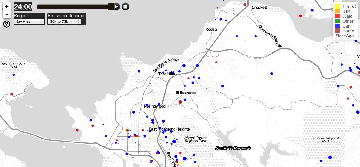
(A still of commute patterns in the East Bay. Screen grab via: Activemaps)
Data is an empowering and effective tool for better understanding our everyday lives, and when that information can be easily digested through visuals we are all the more grateful. With this in mind, a thank you is due to UC Berkeley planning Ph.D. student Fletcher Foti, who recently compiled commute patterns in greater New York, Los Angeles, and the San Francisco Bay Area, and created an interactive visualization called “Active Maps.” Active Maps shows a day of travel from recent travel surveys and can be sorted by income and zoomed to specific areas. Each circle represents a person, and the size of the circle represents the age of the person. When looking at the East Bay, it’s interesting to note regardless of income, transit and walking appear to be most prevalent around Berkeley and Oakland whereas the surrounding parts of Alameda and Contra Costa County appear more car-dependent.
For additional coverage, visit The Atlantic City and San Francisco Streetsblog.
*(Note: the default map is for New York, though you can click on the drop-down bar to select the San Francisco Bay Area)
Uber Offering Free Rides In The East Bay Friday, Jan. 17 – Monday Jan. 20, 2014

Uber is offering free rides in the East Bay this weekend. The offer includes two free rides up to $30 in value for travel in and between Oakland, Berkeley, Albany, Piedmont, El Cerrito, Lamorinda, Alameda, San Leandro, San Ramon, Danville, Walnut Creek and Pleasant Hill. Uber is advising users taking advantage of the promotion this weekend to expect delays due to high demand.

Uber rates are fixed and rides are arranged by smartphone. After summoning a car on the Uber app, customers can watch their ride approach on the app’s map. The Uber website notes there’s “no need to tip.”
The East Bay giveaway follows a price cut in 16 cities announced last week after the spate of bad publicity. Uber told drivers it was sacrificing almost all of its revenue with an eye on capturing new users, according to the San Francisco Chronicle.
The current rate is an initial fee of $3 plus $1.50 a mile. On Wednesday morning, a ride from MacArthur BART to Oakland International Airport was $25. The wait time was six minutes.
The free rides in the East Bay begin at noon on Friday, Jan. 17 and end at 11:59 p.m. on Monday, Jan. 20.
Use the promotion code: EBLOVESuberX.
Read the full Uber blog post.
Great Race For Clean Air (2014)

Join us in the Great Race for Clean Air! March 1 – April 30, 2014
The Great Race for Clean Air is a friendly competition between Bay Area companies to improve air quality and reduce traffic congestion by encouraging employees to change how they commute to work.
Register to receive a Great Race toolkit including posters and outreach materials. Participating employees use the 511 Trip Diary to track their clean commutes.
Clean commutes include:
- Walking
- Biking
- Transit
- Carpooling
- Anything but driving alone to work! Companies and individuals can win recognition and prizes.
Registration for the Great Race for Clean Air commuter challenge opens on January 6, 2014 at www.sparetheair.org. Contact Stephanie Anderson sanderson@communityfocus.org for details.
New California Traffic Laws in Effect for 2014
 Happy New Year from 511CC!
The California legislature has released a new set of traffic laws in effect for 2014, to be enforced by the CHP and other agencies.
Here are some of the new laws effective January 1, 2014.
Take a minute to familiarize yourself with the changes:
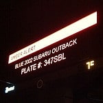 AMBER Alert: Expansion (AB 535): This law requires law enforcement to request activation of the AMBER Alerts after receiving a report that a child has been taken abducted by anyone, including a custodial parent or guardian, who may cause serious bodily injury or death to the child.
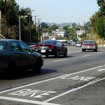
Bicycles: Passing Distance (AB 1371): (This law will go into effect September 16, 2014.)This law prohibits motorists from passing a bicycle with less than three feet between any part of the vehicle and any part of the bicycle ordriver. When three feet is not possible, the motor vehicle must slow to a reasonable and prudent speed and only pass when no danger is present tothe bicyclist. Failing to do so can incur a fine, regardless of a collision or not.
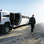
Charter Bus Carriers: Limousines: Emergency Exits (SB 109): By January 1st, 2016, every limousine that has been modified or extended toaccommodate additional passengers shall have two rear doors and one or two internally removable rear emergency windows. If such modifications occurred on or after July of 2015, these requirements apply immediately after July 1st, 2015. All new limousines manufactured after January 1st, 2015 must meet these requirements as well.
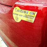
High Occupancy Vehicle Lanes (AB 266 / SB 286, Yee): Together these laws extend sunset dates for low emission, zero emission vehicles tooperate in high occupancy vehicle lanes (HOV) without meeting occupancy requirements to January 1, 2019.
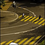
Hit and Run: Statute of Limitations (AB 184): This law extends the statute of limitations for hit-and-run collisions in which death or permanent, serious injury was a result. A criminal complaint may be filed within three years of the offense, or one year after the person was initially identified by law enforcement as a suspect in the commission of the offense, which ever comes later, but in no case more than six years after the offense.
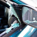
Registration Fees: Vehicle Theft (AB 767): This law authorizes counties to increase registration fees by $1 for passenger vehicles and $2 forcommercial vehicles to fund programs related to vehicle theft crimes in those counties

Search Warrants: Chemical Tests (SB 717): (This law has been operative since September 20, 2013.) This amendment to current law authorizes the issuance of a search warrant to draw blood from a person in a reasonable, medically approved manner, to show that the person violated misdemeanor DUI provisions when that person has refused an officer’s request to submit to, or has failed to complete, a blood test.
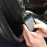
Teen Drivers (SB 194): This law prohibits a person who is under 18 years of age from using an electronic wireless communications device to write,send, or read a text-based communication while driving, even if it is equipped with a hands-free device.
To read the full text of each bill, visit the official California Legislative site, click the Bill Information tab. Enter the bill number listed in parentheses next to each new law above (e.g. 1854) next to “Bill Number:” and select 2013-2014 next to “Session Year:”, then click Search.
Previous Lists Summarizing New California Traffic Laws by Year:
BART Fares to go up January 1, 2014
 BART fares will increase by 60 cents for the longest trip and 25 cents for shorter trips on January 1, 2014. The fare hike is part of the BART’S regularly scheduled inflation-based increase program established in 2003.
The agency’s nine-member elected board has earmarked the estimated $325 million in additional fare proceeds through 2020 to pay for new rail cars, improvements at its Hayward maintenance yard and a new train control system.
For full details, see the updated fare chart.
New and Improved StreetMix (2013)
Back in April of 2013 we shared an article about StreetMix, the fun web-based tool which lets you resize and rethink streets with mere clicks. When it launched, StreetMix was rather simplistic but that’s partially what made it so powerful and why we wrote about it– because of its ability to let everyday people redesign streets and plainly communicate ideas typically reserved for traffic engineers. StreetMix has since been updated with more details and ways to re-envision streets (light rail, and green-painted bike lanes, anyone?), but it has maintained its simple and user-friendly approach.
Take a look below for a comparison of what StreetMix used to look like and what it looks like today…

It certainly looks more polished and more aesthetically pleasing now, doesn’t it? It may explain why a growing number of neighborhood advocacy groups and city agencies are using the app.
Re-designing streets can be a for exercise for all ages and increasingly it has become necessary to design our streets to be inclusive places; StreetMix can help accomplish this goal. Asking youth how they might re-envision streets in their neighborhood using this tool can help inform the needs and decisions of tomorrow.
Check out the new and improved StreetMix!
Bay Area Bike-Share– Helping Us Get Around (2013)

Will the streets of the Bay Area soon be full with a sea of bike-share commuters cycling that last mile from BART to the workplace? Only time will tell. Photo credit: Richard Masoner
The Bay Area is not new to transportation innovations. Last year, we celebrated four successful decades of the visionary commuter rail known as BART, which stills sees climbing ridership and continues be seen as a model of sustainable transportation for the rest of the nation. Coincidentally, last year also marked the 75th anniversary of another incredible Bay Area infrastructural transportation monument, the Golden Gate Bridge.
Today, the Bay Area is leading the way in California again*, albeit with a subtler and humbler infrastructural feature, but one that nonetheless has the potential to hugely impact the way we move– Bay Area Bike Share. Bay Area Bike Share just launched Thursday, August 29th, so the system is merely in its infancy, but similar systems have been around Europe for a while in cities such as Paris and London, and New York City was recently graced with its own iconic bike share earlier this year. Stateside, bike-share programs so far has proven to be surprisingly successful, especially in New York and D.C. Here in the Bay Area, bike share seems to have great potential to compliment our existing excellent regional public transport system, which is perhaps why Bay Area Bike Share is initially launching in Downtown San Francisco and along the Caltrain corridor in Redwood City, Palo Alto, Mountain View and San Jose.
Here’s how the system works:
- Get a Bay Area Bike Share Membership (or pay for a single day use, but longer membership quickly pay off).
- Use Annual Member key or enter your Ride Code (provided to 24-Hour and 3-Day Members) to unlock a bicycle from any station.
- RIDE – Run errands, ride to and/or from your BART station, commute to work, or just go for a spin and use it as a gym membership of sorts!
- Return the bike to the nearest station.
- Repeat steps 2 through 4. Remember, any trip under 30 minutes is free– and yes you can simply dock a bike and check out a new one for another 30 minutes of charge-free cycling.
Bike-share bikes are NOT intended for long trips and the pricing system reflects this. For example, using a Bay Area Bike Share bike for an hour and a half before returning it to a station, will cost you $12 in addition to your membership fee. Any trip under 30 minutes, however, is completely free after membership fee is paid.
So what are bike share bikes good for? Going to meetings or grabbing a bite to eat on your lunch break; cycling from a BART station to your office (at the moment, most downtown San Francisco BART stations have bike share stations nearby); replacing bus trips under three miles with a bike ride; avoiding having to bring your own bike on BART; the infamous last-mile… The possibilities are many, and as long as your journey takes less than 30 minutes (keep in mind, at a “no sweat” pace, one can easily cover at least three miles on a bicycle), using a Bay Area Bike Share bicycle is free. Because of this structuring, getting an annual membership is particularly enticing as it can save you money, especially if you use it to replace short bus trips and cab rides when getting around congested parts of San Francisco.
So what do you think– are you ready to take a Bay Area Bike Share bicycle for a spin?
For additional information, check out Bay Area Bike Share’s Frequently Asked Questions or Contact page. And if you are on social media, feel free to check out Bay Area Bike Share on Twitter, Facebook, Tumblr or Instagram.
*While Bay Area Bike Share is not the first bike share system to launch in California, it is by far the largest and is also distinguished in that it is regional and not confined to a single city, integrating the system well with our existing public transportation network and commuter routes.

