 If you’ve got a teenage driver in the house, or a teen who’ll be driving soon, a great way to help them stay safer behind the wheel is to bring them to the CHP Smart Start Driving Safety Program. This two-hour driver safety class targets new and future licensed teenage drivers and their parents. On the evening of Thursday, October 2, all are invited to attend the Smart Start class at Deer Valley High School.
Presented by the California Highway Patrol, Streets Smarts Diablo and Deer Valley High School, the event is free and open to all students and parents, but registration is requested. Click here to register.
The class will be held in the Theater of Deer Valley High School (at 4700 Lone Tree Way) in
Antioch from 7-9pm. For more information, call Street Smarts Diablo at 925-969-1083.
Category: News
Overview of California Driving & Cycling Laws (2014)

With California’s Three Feet for Safety law now in effect, we thought we’d present an overview of California laws designed to help drivers and cyclists share the road safely
Motorists & Cyclists
- Rights and Responsibilities: Cyclists have the same rights and responsibilities as motorists. Both have the right to use the roadway; both are responsible for signaling turns and stops, as well as stopping at all red lights and stop signs. (CVC 21200, CVC 22107, CVC 22111)
- Yielding to pedestrians: Drivers and cyclists must yield to pedestrians, whether they are crossing the roadway within a marked crosswalk or within an unmarked crosswalk at an intersection. Crosswalks must be left free and clear for pedestrians. (CVC 21954 (b), CVC 21950, CVC 21455)
- Blocking a Bike Lane: Neither motorists nor cyclists may stop in a bike lane or on a bike path. (CVC 21211, CVC 22512)
- Turning Out of Slow Moving Vehicles: On a two-lane highway where passing is unsafe because of traffic in the opposite direction or other conditions, a slow-moving vehicle (including bicycles and passenger vehicles) behind which five or more vehicles are formed in line, shall turn off the roadway at the nearest place designated as a turnout or wherever sufficient area for a safe turnout exists, in order to permit the vehicles following it to proceed. (CVC 21656)
Motorists
- Passing Cyclists: When passing a cyclist, motorists are required to allow at least three feet between their vehicle and the cyclist. If doing so would cause a hazard, they must slow down and pass the cyclist only when it is safe to do so. (CVC 21760)
 Turning Across a Bike Lane: When making a right turn that involves crossing a bike lane, the driver must merge into the bike lane and turn from the curb. State law requires that all right-hand turns be made from “as far right as practicable.” (CVC 21717, CVC 22100)
- Opening and Closing Doors: Before opening doors, drivers must look for oncoming traffic and may not open the door unless it is reasonably safe to do so and can be done without interfering with the movement of traffic. The door must not be left open longer than necessary to load or unload passengers. (CVC 22517)

Cyclists
- Travel Lanes: Cyclists moving at less than the speed of traffic must ride as close to the right side of the road as is safe & practicable. Cyclists have the right to take the lane when passing, preparing for a left turn, if the lane is too narrow to share, or if they are approaching a place where a right turn is authorized. (CVC 21202)
- Bicycle Lanes: On a roadway with a bike lane, bicyclists traveling slower than traffic must use the bike lane, with the same exceptions as noted above. (CVC 21208)
- Moving Left to Avoid Hazards & Pass: Cyclists are allowed to move left to avoid hazards like fixed or moving objects, hazardous surface conditions, animals, glass, etc. This includes moving left when passing a vehicle (esp. a turning vehicle turning right) or another bicycle traveling in the same direction. (CVC 21202 (a))
- Riding on Sidewalks: Individual cities and counties control whether bicyclists may ride on sidewalks. Check local regulations. (CVC 21206)
Bicycle Operation & Required Equipment
- Helmets: Cyclists and bicycle passengers under age 18 must wear a helmet when riding on a bicycle. (CVC 21212)
- Head phones: Bicyclists may not wear earplugs in both ears or a headset covering both ears. (CVC 27400)
- Use Lights at Night: A white headlight and reflectors are required by law if riding when it’s dark. (CVC 21201)
- Ride with a Brake: A bike must be equipped with a brake that enables the rider “to make one braked wheel skid on dry, level, clean pavement.” (CVC 21201)
Free Teen Driving Safety Program: September 17, 2014 (Martinez)
If you’ve got a teenage driver in the house, or a teen who’ll be driving soon, a great way to help them stay safer behind the wheel is to bring them to the CHP Smart Start Driving Safety Program. This two-hour driver safety class targets new and future licensed teenage drivers and their parents. On the evening of Wednesday, September 17th, all are invited to attend the Smart Start class at Alhambra High School.
Presented by the California Highway Patrol, Streets Smarts Diablo and Alhambra High School, the event is free and open to all students and parents, but registration is requested. Click here to register.
The class will be held in the Performing Arts Building of Alhambra High School (at 150 E Street) in
Martinez from 6-8pm. For more information, call Street Smarts Diablo at 925-969-1083.
County Connection and BART Offer Free Passes for School Trips
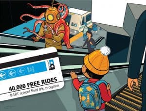 Both BART and County Connection have announced the return of programs offering free passes for school trips.
Thanks to funding from the Monterey Bay Aquarium, the ‘Free BART Rides for School Field Trips’ program is back and will offer 40,000 free trips for students, teachers and chaperones traveling with their schools to cultural and educational destinations. Bay Area schools in Alameda, Contra Costa, San Francisco and San Mateo Counties are eligible to apply and applications are currently being taken on a first-come, first-served basis through December 31st, 2014. Each school will have a limit of six free trips per year. Interested schools can find more information on the ‘Free BART Rides’ page and make a reservation using the program’s online form.
County Connection offers the ‘Class Pass Program’, designed to help familiarize students with public transportation. Teachers are invited to take students on free trips twice per school year using County Connection’s ?xed-route bus system—Monday through Friday, during off-peak hours. In addition to free passes, participating groups will be provided s a specially designed ‘Class Pass’ to use when boarding as well as a personalized trip plan with system maps and schedules. Full program details and an application form are available on the County Connection Class Pass page.
Richmond to San Francisco Ferry Service on Fast Track to Return (2014)

A proposal by the Bay Area Water Emergency Transportation Authority (WETA) could result in ferry service between Richmond and San Francisco as early as 2015.
WETA (the operator of San Francisco Bay Ferry) is responsible for establishing new ferry routes that reduce traffic congestion and can serve as critical transportation in the event of an emergency. Although Martinez, Antioch and Hercules were among the potential locations considered for terminals in Contra Costa, “The most financially feasible is Richmond,” said Kevin Connolly, Manager of Planning and Development with WETA.
According to Richmond City Councilmember Tom Butt, “There are a number of factors influencing the decision to implement the Richmond to San Francisco ferry service before other potential routes.” For one, capital costs to re-fit the existing Richmond Ferry Terminal at Ford Point are far lower than for the other proposed expansion projects. In addition, projected 2015 ridership for the Richmond Terminal is strong (at 950 daily boardings), with fare revenues expected to cover up to 45% of operating costs. Although the balance would need to be covered by Measure J sales tax funds, $45 million has already been earmarked for ferry service in Richmond and Hercules.

The site of the proposed ferry terminal is about 1.5 miles south of downtown Richmond, making it extremely accessible by various modes of transportation. Ford Point is on the Bay Trail, making biking to the proposed ferry terminal simple enough. AC Transit Route 74 (which also connects to Richmond BART) makes the trip Monday-Sunday from Downtown Richmond to Ford Point in just 17 minutes. And for those getting to the ferry terminal by car, a large parking area already exists at the site.
At present, the project is undergoing environmental impact reviews, which should be completed by fall of this year. Once these are completed, final design, permitting and construction of terminal improvements and vessels can begin. This means Richmond ferries could be running as early as 2015. As far as the actual timeline, “The real thing that drives it is how long it takes to build boats,” according to Connolly.
The estimated travel time of the new ferry between Richmond and San Francisco is 23 minutes, compared with 38 minutes by BART and 28 minutes by car (without traffic). The final fare structure has not yet been announced, but some lucky passengers were able to get a sneak preview on a test run of the new route in July of this year.
The Contra Costa Transportation Authority (CCTA) is currently soliciting feedback on what type of transportation investments people would like to see at KeepContraCostaMoving.net.
To view full details of the Richmond Ferry Terminal Project, visit the information page on the WETA website.
Share Your Ideas to Help Shape Contra Costa's Transportation (2014)
The Contra Costa Transportation Authority (CCTA) is updating the Countywide Transportation Plan and they would like to hear your ideas on how to keep Contra Costa moving. CCTA is responsible for maintaining and improving Contra Costa’s transportation system by planning and funding key projects, like the Caldecott Tunnel Fourth Bore, Highway 4 widening, and BART system extensions. The agency also helps maintain local streets, reduce traffic congestion, and make Contra Costa safe for bicyclists and pedestrians all in efforts to get you where you need to go.

The CCTA in collaboration with Contra Costa municipalities and cities want to know what transportation issues you think are important so they can prioritize where to spend time and resources – BART? Buses? Highways? Local roads? Pedestrian paths? Bicycle routes? Do you have new ideas? You tell them. This is your chance to participate in setting the priorities for our transportation system and suggest your own bright ideas for new projects and programs in Contra Costa. There are many ways you can provide your input:
Attend a public workshop to hear more about the CTP. Here’s a list of the upcoming workshops:
-
- Southwest County Public Workshop: Wednesday, September 10, 2014, 7pm, Veteran’s Memorial Building, 3780 Mt. Diablo Blvd, Lafayette
- West County Public Workshop: Saturday, September 20, 2014, 1:30pm, Richmond Convention Center, Bermuda Room (enter from Nevin St.) 403 Civic Center Plaza, Richmond
- West County Public Workshop: Monday, September 22, 2014, 7pm, Hercules Community Center (Gym), 2001 Refugio Valley Road, Hercules
- Telephone Public Workshop: Tuesday, September 23, 2014, 6pm, Dial 877-229-8493 and pin# 1126642 when promptedP
- Past event: Central County Public Workshop: Wednesday, August 27, 2014, 7pm, Assembly Hall at Civic Park Community Center, 1375 Civic Drive, Walnut Cree
- Past event: East County Public Workshop: Thursday, August 28, 2014, 7pm, City Council Chambers, Pittsburg Civic Center, 65 Civic Avenue, Pittsburg
- Participate in CCTA’s online survey at www.KeepContraCostaMoving.net, to share your priorities, your bright ideas, and see what other ideas have been submitted.
- Call 925-256-4720 or email 2014CTP@ccta.net to have a copy of CCTA’s survey mailed to you.
Your opinions and ideas will help shape Contra Costa County’s transportation planning for the next 25 years. Don’t miss this opportunity!
CTP Frequently Asked Questions
English and Spanish Flyer On How To Participate
Reminders for School Zones, Crossing Guards, and Yellow School Buses
As schools are back in session safety officials urge motorists to be especially mindful of their driving behavior in and around school zones and school buses.

Do not pass a school bus with its flashing red lights and stop sign extended in either direction on an undivided highway. If there is a median divider, stop if traveling in the same direction as the bus.
- Be prepared to stop if you see a school bus that has its flashing yellow lights activated. School buses use their yellow flashing lights to warn motorists of an upcoming bus stop.
- Obey the speed limit. Kids are quick and don’t always think before running into the street.
- Do not under any circumstances load or unload your child in the middle of the street or in the second lane of a drop-off circle at school. When dropping off a child pull all the way to the curb so the child exits the car on the right side. Children seated in the left side of the vehicle should exit on the right side of the vehicle.
- Do not park in a red zone. They are there for a reason. You may be blocking the vision of a crossing guard or crosswalk.
- The crossing guard’s stop sign means to stop until he/she leaves the crosswalk.
- When pulling up to a crosswalk leave enough room between your car and the crosswalk so that if you are rear-ended you won’t collide with the guard or children crossing the street.
- When crossing a street with your child, wait for the crossing guard to signal that it is safe to do so. Lead by example and train your child to listen to directions of the crossing guard.
- Your child should never run, ride a scooter, skateboard or bicycle in the crosswalk. Always walk.
- Often the worst offenders of excessive speed and reckless motorist behavior in and around school zones is mom and dad.
Teen Driving Safety Program August 19, 2014
The California Highway Patrol, Street Smarts Diablo, and Pittsburg High School are hosting the CHP Start Smart Driving Safety Program for teen drivers and their parents August 19, 2014 from 6-8 pm at Pittsburg High School Creative Arts Building. Registration is FREE and open to all Pittsburg students and parents. Registration is requested. Click here to register. For more information call Street Smarts Diablo at 925-969-1083.

Start Smart is a two-hour driver safety education class given by the CHP. The class targets new and future licensed teenage drivers and their parents/guardians. For more information call 925-646-4980.
I-80 Closure WB at Carlson Blvd in Richmond (Aug. 2014)
8/6/14 – CONSTRUCTION HAS BEEN RESCHEDULED FOR A LATER DATE.
TRAFFIC ADVISORY – Nighttime Closures on Westbound I-80 to Begin in Early August – Plan for Detours
Caltrans will soon install the first in a series of eleven approximately 25-foot-high overhead sign frames that will span the width of the westbound I-80 lanes. In the coming months, the sign frames will be installed between Cutting Boulevard in Richmond and Powell Street in Emeryville, necessitating lane and full westbound freeway closures in the vicinity of the installations.

Travelers are advised of nighttime lane closures and full westbound closures beginning August 7, 2014. Motorists are advised to expect detours and delays during the nighttime closures.
Beginning Tuesday, August 5: To facilitate sign frame installation, portions of westbound I-80 will be closed from 1 a.m. to 3 a.m. on Tuesdays and Thursdays. The first installation will occur at Carlson Boulevard in Richmond. During this time, westbound lanes will be closed to traffic in the vicinity of the installation, and motorists will be detoured to a local frontage road. Eastbound and westbound lane closures of I-80 will continue on Sundays through Thursdays, beginning at 9 p.m. and ending at 5 a.m.
Every Tuesday and Thursday Continuing Until October:
Caltrans will continue to implement closures on Tuesdays and Thursdays between 9 p.m. the previous evening – 5 a.m. (lane closures) and 1 a.m. – 3 a.m. (full closures) on portions of westbound I-80 until all eleven sign frames have been installed. The second closure and sign frame installation will occur at Cutting Boulevard in Richmond.
Caltrans anticipates that the closures will continue through October 2014. However, this work is weather-dependent, and the schedule is subject to change.
Roadway work entails installing large overhead sign frames that will feature new electronic signage. The signage will be activated in early 2015 as part of a larger network of I-80 SMART Corridor strategies to ease traffic congestion and enhance safety on this heavily travelled corridor between the Bay Bridge Toll Plaza in Alameda County and the Carquinez Bridge in Contra Costa County.
Read the full press release

TRANSPAC Executive Director Job Opening (2014)
TRANSPAC Executive Director Recruitment
The Position
The Executive Director is the administrator of major transportation programs and projects in Central Contra Costa County. S/he will supervise 511 CCTA, the Transportation Demand Management program and manage a team of up to nine staff. In cooperation with the TRANSPAC Board of Directors, the Executive Director is responsible for strategic planning and visioning for the agency. This is a full time position including preparation of two TRANSPAC meeting agendas and attendance at TRANSPAC and multiple other committee meetings per month. The Executive Director should have solid experience in transportation planning, as well as expertise in responding to CEQA documents, traffic studies and other reports. The Executive Director may be a firm or individuals.
The Transportation Demand Management program, principally funded by grants and local sales tax funds, will require the new Executive Director’s part-time, on-site supervision, support and guidance. Along with the TDM Program Manager, the Executive Director will help shape how a new generation of commuters will meet the challenge of getting to and from work. With the launch of SB 1339 in the Bay Area (Regional Commuter Benefit legislation), many more employers will be required to participate in TDM activities.
To apply for this outstanding opportunity, please submit a cover letter and complete resume by September 7, 2014 to transpacexdir@gmail.com. Candidate screening will occur following the closing date, with interviews for top candidates to follow on or about Sept 11, 2014.
Contact transpacexdir@gmail.com for additional information. Attn: TRANSPAC Executive Director Recruitment
Qualifications
Possess strong transportation planning, program and project delivery experience. Be knowledgeable about transportation funding and have financial acumen, business savvy, and strong negotiation skills. Present well-researched recommendations to the Board, with excellent rationale, and implement programs and projects effectively and on schedule. In addition, the successful candidate will look at all aspects of an issue and evaluate and offer several alternative solutions when appropriate. Be politically astute and able to explain complex subjects succinctly to individuals with varying levels of knowledge regarding transportation projects and issues. In addition, s/he must explain and promote programs and policies to the media and the public in a positive manner. Develop, value and foster a team environment that strengthens collaboration and ensures cooperation from an agency-wide perspective. Be a hands-on leader who will work side-by-side with staff to achieve the greatest good for TRANSPAC. Have outstanding interpersonal skills to facilitate transportation dialogue with affected stakeholders and exhibit excellent communicate skills, including interacting with City Managers and Council members in a professional and sensitive manner. Handle multiple projects and possess the ability to track the progress of projects and programs with support of staff. Have an understanding of and sensitivity to economic, language, and cultural differences within the area. Experience working in a region similar to Central Contra Costa County is desired. Any combination of experience and education that would likely provide the required knowledge and abilities is qualifying. A typical way to obtain the required knowledge and abilities would be a bachelor’s degree from an accredited four year college or university in transportation planning, urban planning, civil engineering, public administration, business administration, or a related field and practical experience. An advanced degree or additional related coursework is strongly preferred. A career of increasingly responsible experience in similar positions or in transportation planning is desired.
A Clever Hack for Cycling in Skirts

Skirts can be lots of fun, but can be a huge hassle on two wheels. How to keep your lovely garment from getting tangled or otherwise being a pain? These ladies from across the pond have a simple solution: put a penny in yo’ pants.
- Find a penny or something similar.
- Find a rubber band.
- Now put on your “favourite” skirt!
- Push the penny from the back of your skirt to the front, through both layers.
- Form a button at the front of the skirt, using both layers.
- Wrap the band around the button making sure it’s secure.
- Now get out there and enjoy your new freedom!
Their brilliance doesn’t end there. They’re developing a modification to the penny/rubber band design that will be more gentle on fabric, and donating some of the proceeds to the Afghanistan Women’s National Cycling Team. Visit their site to learn more.
Traffic Shift Near Antioch SR-160 Ramps to Hwy 4 (Jul. 2014)
The California Department of Transportation (Caltrans) and the Contra Costa Transportation Authority (CCTA) are constructing two new connector ramps, one connecting westbound State Route (SR)-4 to northbound SR-160, and one connecting southbound SR- 160 to eastbound Highway 4 in Contra Costa County. This construction work will require a traffic shift on southbound SR-160, between Main St and westbound SR-4.
The traffic will transition from the currently traveled lane to a newly paved lane which begins near the Main St. on-ramp, which may cause an intermittent closure of the highway. The traffic shift will begin July 16, 2014, between 10 p.m. and 4 a.m. and may cause intermittant closure of the the highway. Read the full traffic advisory

Traffic Delays on Willow Pass Rd in Concord (Jul. 2014)
Motorists are being advised to expect delays on a major downtown Concord thoroughfare starting today as crews work to upgrade a sewer line in the area. The roadwork will take place on Willow Pass Road between Mira Vista Terrace and Galindo Street from 8 a.m. to 6 p.m. Monday through Friday. The target completion date is August 29, 2014.
Willow Pass Road will be open but traffic will likely be slow in the area due to lane closures. The City is in the process of replacing the sewer lines in the downtown area. Many of the lines are clay pipe from the ’40s and ’50s, and are undersized or failing. The project is being funded through the City’s Sewer Enterprise Fund. For more information, contact Project Engineer Bob Addiego, Swinerton Consulting, (925) 270-5636

Coming Soon to the East Bay: Bay Area Bike Share (2014)

In less than a year, these baby blue bikes have zipped around San Francisco and the peninsula on over 200,000 trips, and soon, even in the East Bay. This spring, the Metropolitan Transportation Commission (MTC), which supplied much of the original funding to launch the Bay Area Bike Share, committed $8.7 million to expand the system to the East Bay. Here are the three things you need to know.
1) How Does Bay Area Bike Share Work?
You can join Bay Area Bike Share for a $88 annual pass, $22 three-day pass, or $9 for a 24-hour pass. Annual members get a fancy electronic key fob, and other members can just get a keycode from the bike station itself. Enter your keycode into the bike’s dock, pop out the bike, ride it some place fun, and then return it to that or another dock within 30 minutes. There’s a mobile app and website to help find an available bike or empty dock.
2) Where Will the New Bike Stations Be Located?
In this phase, the 750 new bikes will be distributed between Oakland, Berkeley, and Emeryville. MTC will be conducting a public planning process to make sure the bike stations are located where people need them.
3) When Can I Get On A Bike?
It is anticipated that the bike stations could be on the street during the spring of 2015 . Look for a launch date to be announced later this year, which MTC is hinting could be before Bike to Work Day in May.
How Do I Learn More?
If you’re on Twitter, follow @SFBayBikeShare, @BikeEastBay or @MTCBATA for the latest. Or subscribe to our newsletter, which goes out every second Tuesday with the latest transportation news for Contra Costa County and the East Bay.
Announcing The #ViewFromCC Photo Contest (2014)
The Bay Area is beautiful, and some of the best views are from trains, buses, bikes, bridges and feet.
Have you ever taken the TransBay bus across the Bay Bridge, and realize that the extra height gave you an incredible view of the Bay? Or leaned back in your BART seat over Albany and enjoyed the view of the East Bay hills on one side and fog-shrouded San Francisco on the other? Or appreciated the simple bliss of a cup of coffee, power outlet, and wifi on the Capitol Corridor?
Commuters travel throughout this incredible region all the time, and when we get out of our cars, we don’t have anything else to do but enjoy the journey.
511CC invites you to document, share, and celebrate this unique viewpoint with its new #ViewFromCC contest. Each month, we’ll name a new way to get around (it could be a transit service, carpool, vanpool, bikes, or feet), and you send us a glimpse of your view from that perspective. We’ll pick a favorite, and send the winner a $20 Peets gift card.
Official rules:
- Each month’s #ViewFromCC theme will be announced on Twitter and newsletter on the second Tuesday of the month. You can follow us or subscribe to the newsletter and be the first to hear.
- Submissions are accepted two ways.
- Tweet your photo and tag it with the #ViewFromCC hashtag, or
- Email it to us at ViewFromCC@511cc.org
- Winners will be selected by 511CC staff and announced via Twitter and newsletter the following month. Entries will be judged on their ability to portray the chosen theme in an appealing, different, and positive light.
- Winners will be asked via Twitter or email (based on their submission method) for a mailing address to send the gift card.
- The contest is open to everyone, but the winner must supply a mailing address in Contra Costa County (either work or home) to receive a gift card.
Ready to get started? July 2014’s theme is BART. Show us your #ViewFromCC!
Traffic Switch on Buskirk Widening Project (Jun. 2014)
Traffic Alert for Buskirk Avenue beginning June 26, 2014
1) The new roadway section on the east side of Buskirk Avenue between Crossroads and Clarie Drive will now be open to one lane for northbound traffic.
2) The new Hookston Road section (old Elmira Drive) between Hookston Road and Clarie Drive will now be open to one lane of traffic in each direction.
3) Hookston Road between Old Elmira Drive and Buskirk Ave will be permanently closed to through traffic, this will allow for construction of the underground and storm basin facilities and a new mini-park in this area. Driveway access for the Hookston Square Business Park and the adjacent office complex will be provided through Buskirk Avenue and the west side of Hookston Road.
4) Traffic signals at Buskirk and Clarie will now be fully operational.
Expect delays as during the switch over operation, permanent roadway striping and signing during this phase of work between 8:00 a.m. and 4:00 p.m. For more project information www.pleasant-hill.net/buskirk
From the Archives: Old AC Transit

(Photo credit: AC Transit)
While it’s true all eyes are set on modernizing our transit system, AC Transit uploaded some fantastic pictures of buses and billboard ads from the 1960’s and 70’s. We salute AC Transit’s fleet and campaigns from half a century ago! (All photos courtesy of AC Transit)


Can’t get enough of old-school AC Transit? The agency has dozens of more old photos in its “From the Archives March 2014” flickr set. And if you’re on Facebook, check out the Vintage AC Transit page and give it a “like” for more pictures and history.
Closer Look at The Amazing "Hovenring"
With thousands of likes, shares, re-blogs, tweets, comments and views, the floating bicycle roundabout known as “Hovenring” may well be the most popular piece of bicycle infrastructure around the globe. It really is quite impressive, in fact we blogged about it shortly after it was first unveiled. Visually, it’s sleek and beautiful…
… but there’s more to the story.
The project was an engineering feat that had to overcome some obstacles. Ethan Siegel, writing for Starts with a Bang!, notes:
“A huge challenge for building any large, suspended structure is dealing with the inevitable vibrations that will come about, and the Hovenring indeed came face-to-face with that right after its inauguration. A 70-meter (230-foot) tall central pylon was erected, which was then connected by 24 steel cables to the circular bridge deck. All told, the structure weighs in at more than one million kilograms. That much mass, constructed in this fashion, prevented torsion on the structure to keep it stable, but was insufficient to prevent severe vibrations due to winds.”
It took a few months, but the Hovenring eventually overcame all barriers and today sits as likely the most stunning roundabout – bicycle-specific or not – in the world.
For more information about Hovenring, head over to Starts with a Bang! or Twisted Sifter.
Iron Horse Trail Overcrossings Input Requested (2014)
The Iron Horse Trail Overcrossings Project is looking for new design ideas for the bicycle and pedestrian overcrossing on Bollinger Canyon Road and Crow Canyon Road in San Ramon. Bring your ideas to the workshop on May 20, 2014 from 6-8 pm at San Ramon Community Center Fountain Room.
Iron Horse Trail Overcrossings Project is a collaborative effort between the City of San Ramon, Contra Costa County, and the East Bay Regional Park District.

Caltrans Report: Walking, Biking, Transit on the Rise (2014)

In March, Caltrans released the results from its latest California Household Travel Survey (CHTS), which looks at how we in California travel. The primary finding echoes what many suspect– Californians are driving less. The percentage of California residents walking, biking, or using public transportation more than doubled since 2000; the three modes increased in mode-share, collectively, from 11 percent to 23 percent.
Caltrans Director Malcolm Dougherty notes of the survey’s findings, “Based on this research, we can make good decisions about transportation that will improve mobility, air quality, and travel choices for all Californians and make our state a better place to live and work.”
The table below from the recent CHTS shows the exact breakdown of travel mode distribution, and how it compares to the 2000 survey:
 Single-occupancy cars remain the most prevalent travel mode. However it now makes up less than half of all trips, having plummeted from 60.2% to 49.3% of trips.
Interestingly, despite frequently hearing about today’s public transit and bicycling booms, the fastest growing travel mode in the Golden State over the last decade was walking, which more than doubled from 8.4% of trips to 16.6% trips. This is not to say that reports of increased levels of public transit use and bicycling are misleading, in fact the two modes doubled their respective mode-share since Caltrans’ 2000 CHTS.
The results from the survey mark a dramatic shift in the state’s travel patterns and show no signs of reversing. Looking at the numbers one can’t help but to wonder– what will the next California Household Travel Survey look like?
Cool Stuff at BTWD 2014 Energizer Stations
BTWD is Thursday, May 7, 2014. There are a lot of energizer stations to visit in Contra Costa. All are providing SNACKS and some are providing: bike repair, smoothies, bike lights, Peet’s Coffee, slushies, and more! Stop by a few stations to say hello and for a full listing of energizer stations click here.
Here is a sneak peek at a few stations with unique attractions or giveaways.
Kaiser Permanente Walnut Creek Medical Center, Walnut Creek, Corner of S. Main St & Newell Ave, 7:00-10:00 am
A DIY bike repair tools for minor needs, cool bike light, and 5 Thrive Dollars!
Argent/Umpqua Bank, Concord, 1900 Grant St (Todos Santos Plaza) 3:00-6:00 pm
Along with Farmers Market, inaugural bike corral bike-check in, bike station for minor repairs.
Pleasant Hill BART, near bike racks 6:30-9:00 am, hosted by REI
Expert bike technician on site to provide a quick check and adjustment of brakes, drive train, tires, chain lube.
Iron Horse Trail at Bollinger Canyon Rd, San Ramon 6:00-10:00 am, hosted by City of San Ramon/Bishop Ranch Transportation Centre/Whole Foods Market
Spin on the bike blender and enjoy a fresh smoothie!
Contra Costa Canal Trail off N. Wiget Ln, Walnut Creek 7:30-9:00 am, hosted by Renaissance ClubSport
TEAM ClubSport will be there as will for support with any bike concerns or basic instruction if needed.
Contra Costa Canal Trail off N. Wiget Ln, Walnut Creek 4:00-7:00 pm, hosted by Sports Basement
Bike mechanics on site and 10% off coupon which if used in-store you get a FREE SB water bottle.
Front of 2730 Shadelands Dr, Walnut Creek 7:00-9:00 am, hosted by Gilbane
Bicycle bells while supplies last!
Walnut Creek BART, 6:00-9:00 am, hosted by Sports Basement
Bike mechanics on site and 10% off coupon which if used in-store you get a FREE SB water bottle.
Walnut Creek BART, 4:00-6:00 pm, hosted by Mike’s Bikes
Bike mechanic available to diagnose and do minor repairs.
Lafayette-Moraga Trail at Olympic Blvd & Pleasant Hill Rd, Lafayette 4:00-7:00 pm, hosted by Sports Basement
Bike mechanics on site and 10% off coupon which if used in-store you get a FREE SB water bottle.
Ygnacio Valley Rd & Contra Costa Canal, Walnut Creek 7:00-9:00 am & 5:00-7:00 pm, hosted by Encina Bicycle Center
Bike mechanic on site to diagnose/make minor repairs.
Iron Horse & Contra Costa Canal Trail intersection,Walnut Creek 6:30-9:30 am and 4:00-7:00 pm, hosted by Contra Costa Transportation Authority/511 CCTA
Spin on the bike blender and enjoy lemonade slushies!
Peet’s Coffee & Tea, Brentwood, 5411 Lone Tree Way #L-130, 6:00-9:00 am, hosted by Schwinn City
Free Peet’s Coffee to cyclists!
Contra Costa County's 2014 Bike Commuter of the Year: Ray Pixton

511 CCTA congratulates Ray Pixton as Contra Costa County’s 2014 Bike Commuter of the Year.
Ray Pixton has been biking to work since 1981 when he started working for the Contra Costa Water District. He is a construction inspector and he rides rain or shine. “It feels weird to drive a car now,” he says, “I have 3 cars and they just sit in the driveway.”
Ray’s coworkers nominated him for the award, writing that his dedication to riding to work inspired them. “It’s news to me,” said Pixton about being an inspiration to his coworkers; “I just thought I was doing my own thing.” His commute is a pleasure, he says, because the 8 miles from Concord to Pleasant Hill allow him to ride on trails alongside the canals he also helps inspect.
It wasn’t always easy though: “I remember my first ride was a 5-mile ride and I just about died, I was so out shape,” Pixton joked, “but I stuck to it.” His commitment helped him out when, in the 90s, he was diagnosed with Type 2 diabetes. “Exercise has been a really important part of my treatment to keep my blood sugar levels down,” says Pixton.
Last year he raised close to $900 for the Tour de Cure, a 50-mile fundraiser ride for the American Diabetes Association. He’s planning on riding again this May and plans on surpassing $900. “It’s been a good goal which helps me train and gets me in better shape, but 50 miles is about my limit – I’m 61 after all!” Pixton is retiring this summer and although he’s not sure if he’s going to stop working, he won’t stop biking. “I’ll miss the commute,” he says.
In addition to an award, Ray Pixton will receive a set of Revolights and a set of Bay Trail Maps to help with his planning adventures.
Read about other Bike Commuter of the Year (BCOY) award recipients in the Bay Area.
Active Transportation to Get $360 Million (2014)
Caltrans, regional transportation agencies and the federal government have combined funds to provide $360 million in grants for the Active Transportation Program (ATP). Active Transportation is a term used to describe walking, biking, and transit. The funds for ATP will be targeted at projects like bike lanes, safer intersections for pedestrians, safety improvements leading to and around transit stops, and non-infrastructure programs like Safe Routes To School safety education outreach.
Jeanie Ward-Waller is the California advocacy organizer for the Safe Routes to School National Partnership. She said this is the most money by far that has been offered to improve walk/bike routes. But she said that it is also unique because the priorities for awarding the money are not just about transportation. Part of the decision about awarding the money will be based on potential boosts to public health. Some money is earmarked for projects in disadvantaged communities. “It’s watershed in terms of supporting walking and biking, but it’s also a watershed in how it is being targeted,” Ward-Waller said. “I think it’s a new standard about how we are approaching transportation and prioritizing things like public health and sustainability and making sure equity is a lens.” Read the full article in California Report.

Lane #1 of SR-160 in Antioch to Be Closed Temporarily (Apr. 2014)
Caltrans will close Lane #1 of SR-160 in Antioch, in the northbound direction between SR-4 and the 18th Street/Main Street off-ramp on Thursday evening, April 24, from 6:00 pm to 6:00 am. Calrtrans and the Contra Costa Transportation Authority (CCTA) are constructing two new connector ramps, one connecting westbound Highway 4 to northbound SR-160, and one connecting southbound SR-160 to eastbound Highway 4 as part of the Highway 4 improvements.
The Highway 4 projects include improvements that will help revitalize eastern Contra Costa County. The projects expand Highway 4 from four to eight lanes between Loveridge Road and SR-160, add two connector ramps between Highway 4 and Highway 160, and add a BART extension from Pittsburg to Antioch (eBART). This will greatly improve transit accessibility for the region and help reduce traffic congestion and enhance the quality of life for the more than 250,000 residents of eastern Contra Costa County. The projects have been carefully staged to keep 130,000 vehicles per day moving as major construction and demolition work continue, and include over *$1.3 billion in State, Federal, Contra Costa Measure C & J sales tax, regional bridge tolls, and other local funds.
